Professor James Tice presented a paper related to his current research, the GIS Forma Urbis Romae Project, at a conference dedicated to the digital humanities in Washington, D.C., at the Center for Advanced Studies in the Visual Arts recently.
Tice’s presentation focused on his “Mapping Rome” project that will provide scholars and others with an innovative tool to study the complex urban fabric of Rome as it has evolved over three millennia. Using advanced GIS technology, this multidisciplinary project intends to create a layered history of Rome by updating the Forma Urbis Romae, the cartographic masterpiece of ancient Roman topography published in 1901 by Rodolfo Lanciani.
This extraordinary map measures 25 by 17 feet and employs an innovative graphic system that represents Rome’s historic urban fabric as a series of layers from ancient to modern. The map remains the standard archaeological reference for Rome even though it does not incorporate the numerous discoveries uncovered since its original publication.
“We plan to critically examine, update, and eventually republish the Forma Urbis Romae map as an interactive website,” the abstract for Tice’s presentation states.
“One of the website’s constituent elements will be an evolving geo-database that will both solicit and incorporate contributions by internationally prominent scholars in the field.”
Tice will also present his research on “Mapping Rome” during the Presidential Research Lecture on February 6, 2015, at 5 p.m. in Lawrence Hall Room 177.

Above: Tice’s project will update the Forma Urbis Romae, the cartographic masterpiece of ancient Roman topography published in 1901 by Rodolfo Lanciani. Image courtesy James Tice.
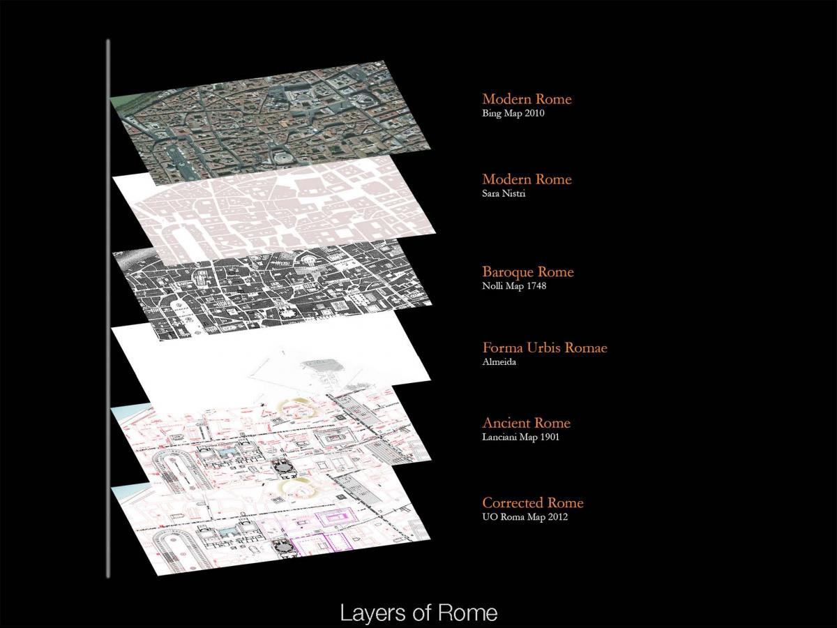
Above: Using advanced GIS technology, Tice’s project intends to create a layered history of Rome by updating the Forma Urbis Romae. Image courtesy James Tice.